


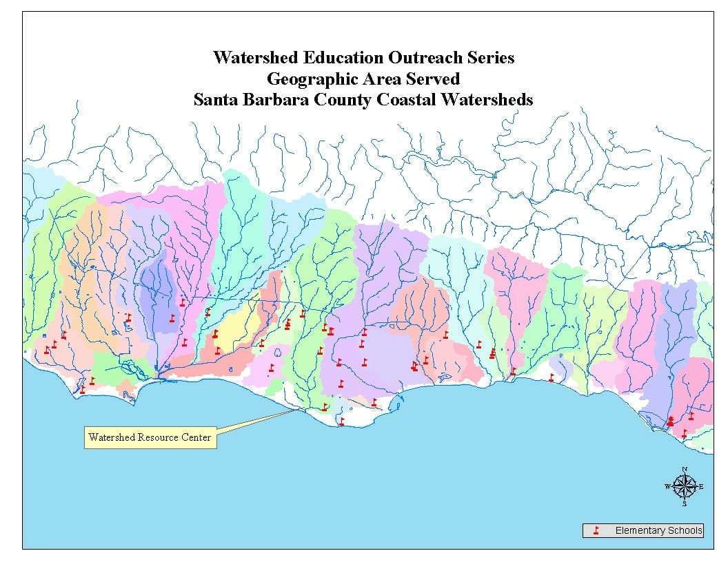

California's diverse landscape is carved by a complex network of watersheds, acting as vital arteries that sustain both nature and human communities. Understanding a California watershed map unlocks critical insights into how water flows across the state, from mountain peaks to coastal estuaries. These maps are essential for anyone interested in the state's ecological health, water management, or simply exploring the great outdoors.
For US residents and local explorers, these detailed maps illustrate the natural boundaries where all precipitation eventually drains to a common outlet. Knowing your local watershed helps you connect with your environment, understand where your drinking water comes from, and recognize how community actions impact water quality downstream. They are practical tools for conservationists, outdoor enthusiasts, and concerned citizens alike.
| Key Aspect | Description for US Audience | Why it Matters Locally |
|---|---|---|
| Watershed Definition | A drainage basin where all water drains to a single point. | Affects local water supply, recreation areas, and flood control planning. |
| Major CA Watersheds | Sacramento-San Joaquin Delta, Klamath River, Colorado River, Salinas River. | Crucial for state agriculture, urban supply, and diverse ecosystems. |
| Map Accessibility | Online via DWR, regional water boards, environmental NGOs. | Empowers citizens to find local data and participate in water initiatives. |
| Conservation Role | Identifies areas for water quality protection, habitat restoration. | Guides local efforts to preserve natural resources and prevent pollution. |
Understanding California's Waterways: A Deep Dive into Watershed Maps
California's watersheds are fundamental to the state's identity, providing lifeblood to agriculture, urban centers, and stunning natural environments. A detailed California watershed map acts as a guide, revealing the intricate patterns of streams, rivers, and lakes that collectively form these critical drainage basins. These maps are more than just lines on paper; they represent the hydrological blueprint of the Golden State, influencing everything from biodiversity to economic stability.
Residents often wonder how their daily water use impacts broader systems, and these maps provide that clarity. They show how urban runoff in Los Angeles might eventually reach the Pacific Ocean, or how snowmelt in the Sierra Nevada feeds agricultural lands in the Central Valley. Understanding these connections is a big step toward appreciating the shared responsibility we all have in protecting California's precious water resources.
Using a good map of California watersheds, you can easily trace the path of water from its source, observing how geographical features direct its flow. This visual journey highlights the importance of upstream conservation efforts and how they ripple through entire regions. It's a powerful educational tool for students, environmental groups, and anyone eager to understand the dynamics of their local environment.
Ultimately, a comprehensive California watershed map helps us make sense of complex environmental data in an accessible format. It encourages a local perspective on global water issues, making it easier for communities to identify specific challenges and collaborate on effective solutions. These maps are truly indispensable for fostering water literacy across the state.
| Map Insight | Practical Application for US Citizens | Benefit to Local-Guide Users |
|---|---|---|
| Source to Sea Flow | Track water from mountains through cities to the coast. | Plan eco-friendly travel routes; identify clean water recreation spots. |
| Ecological Hotspots | Pinpoint areas rich in biodiversity or sensitive habitats. | Discover unique wildlife viewing locations; support local conservation areas. |
| Water Quality Indicators | Observe areas impacted by pollution or successful restoration. | Choose safe swimming or fishing spots; locate community clean-up events. |
| Flood Risk Zones | Identify areas prone to inundation during heavy rains. | Prepare for emergencies; understand local infrastructure needs. |
Navigating California Watersheds for Recreation and Conservation
Finding Your Local Watershed on Maps
Finding your local watershed on a California watershed map is surprisingly simple, especially with online interactive tools provided by state and local agencies. These digital platforms allow you to enter your address or zip code, instantly pinpointing your exact location within a specific drainage basin. This feature is a game-changer for residents looking to understand their immediate hydrological surroundings.
Once you've identified your local watershed, you can explore detailed information about it, including its major rivers, reservoirs, and even local conservation initiatives. Many maps also offer layers that show land use, population density, and ecological features, painting a complete picture of your watershed's health. This wealth of information is invaluable for community planning and engagement.
For outdoor enthusiasts, knowing your watershed means you can identify excellent spots for fishing, kayaking, or hiking along its scenic waterways. It also helps you understand the specific regulations or advisories that apply to water activities in your area, ensuring a safe and responsible experience. Always check for local guidelines before heading out.
| User Action | What to Expect on a CA Watershed Map | Why it's Useful for Locals |
|---|---|---|
| Locating Home Watershed | Clear boundary lines, watershed name, major water bodies. | Understand local water source, pollution pathways, community impact. |
| Planning Outdoor Trips | Hiking trails, fishing access points, scenic overlooks along waterways. | Discover new recreational opportunities, connect with nature responsibly. |
| Engaging in Conservation | Areas of restoration projects, volunteer opportunities, contact info for local groups. | Find ways to contribute to environmental health, protect local ecosystems. |
FAQ Section: Your Questions About California Watershed Maps Answered
What are California's major watersheds?
California boasts numerous watersheds, but major ones include the Sacramento-San Joaquin Delta, Klamath River, Colorado River, and various coastal watersheds. These systems are crucial for the state's water supply, agriculture, and diverse ecosystems. Understanding their locations helps residents identify local water sources and environmental efforts.
How do watersheds affect local communities?
Understanding local watersheds is vital for California communities because it directly impacts water quality, supply, and flood risk. Awareness helps residents participate in conservation efforts, prepare for environmental changes, and support sustainable water management practices unique to their region, protecting local natural resources effectively.
Where can I find an interactive watershed map for California?
Interactive maps of California watersheds are often available through state agencies like the California Department of Water Resources (DWR) or regional water boards. Websites focused on environmental data also provide visual tools. These digital resources allow users to zoom into specific areas, identify watershed boundaries, and access related hydrological information easily.
Do California watershed maps show water quality data?
Many California watershed maps, particularly those provided by environmental and water agencies, integrate water quality data. These maps often display monitoring stations, pollution sources, and overall health assessments of various water bodies within a watershed. This information is invaluable for both public awareness and regulatory compliance.
How do wildfires affect California's watersheds?
Wildfires significantly impact California's watersheds by increasing erosion, altering soil composition, and potentially contaminating water sources with ash and debris. Burned landscapes lose their ability to absorb rainfall, leading to increased runoff and heightened flood risk, which poses long-term challenges for water managers and local ecosystems.
What is the importance of a California watershed map for water conservation?
A California watershed map is critical for water conservation efforts by visually identifying critical areas for protection, restoration, and sustainable management. It helps pinpoint pollution sources, vulnerable ecosystems, and optimal locations for conservation projects, empowering communities to make data-driven decisions that safeguard water resources.
Can I use California watershed maps for recreational planning?
Absolutely, California watershed maps are excellent tools for recreational planning. They highlight rivers, lakes, and coastal areas within specific watersheds, guiding you to prime locations for fishing, kayaking, hiking, and wildlife observation. These maps help you discover local parks and natural areas connected by these vital water systems.